In the discussion of the Map Tool as used for Input,
the emphasis was on marking latitude and longitude positions for a subsequent search.
After a search is performed, users may wish to pass data from that search back to the Map Tool
for geographic visualization. The steps to port results are explained in the description of the
Search Tool.
Here, the Map Tool functions for displaying results geographically will be discussed.
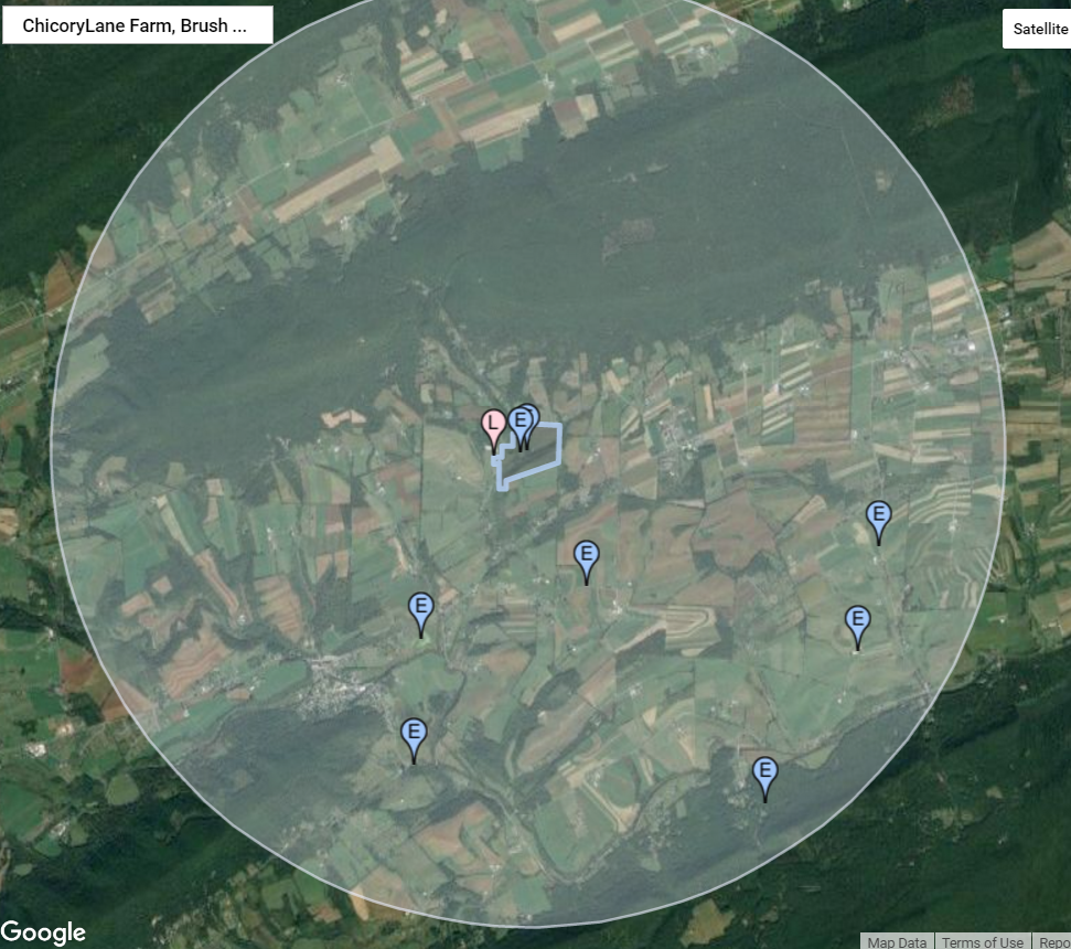
- View Area
Two types of data may be ported from the Search Tool to the Map Tool: area information and sightings information. The area that will be searched for sightings is based on a latitude and longitude that marks the center and a distance or radius out from that point that defines a circle. By porting these data back to the Map Tool, the user can see the actual geographic area defined by those parameters. Note the shaded circle in the image, above, which is based on a distance or radius of 3 kilometers (~2 miles). The command to display a ported area is a right-click on the map followed by a select from the drop down menu of the Import Search Area option.
Actually, the lat/lng and distance values can be ported and visualized prior to a search as well as after. That way, the user can check whether the defined area is the intended area. After visual inspection, one may wish to adjust the center and/or the radius of the search area.
- View Sightings
The second kind of information that can be seen in the image, above, is sighting locations. Each sighting includes a single lat/lng position, the bird observed, numbers, etc. Each sighting location is marked by a blue marker labeled with an "E" (for eBird). The command to display sightings is to right-click on the map and select from the drop down menu the Import Search Results option. This view is useful for noting the geographic proximity of sightings over a general area.
Once the sighting markers are displayed, a summary of key information associated with each may be displayed by left-clicking the marker. See the image, below, for an example.
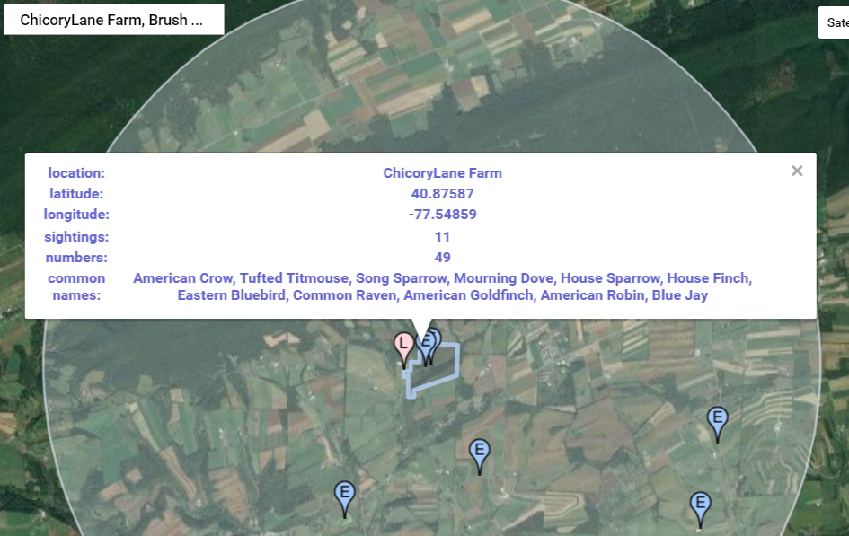
- Sighting Summary
Whereas a more extensive presentation of search results is available in the Search Tool table, the summaries available in the Map Tool include the name of the location, lat/lng, the total number of sighting entries for that position, the total number of birds of all species observed, and the common names of the birds reported. Scientific names are not included here but are available in the Search Tool Table.
Sometimes when several markers are close together on the map and the attempts to click on one of them, the system will spread them out to make selection of a particular marker easier. Once a marker is selected, all of the markers in the cluser will return to their original positions.
- Wrap-up
Whereas these discussions have focused on the Tool's function, they provide interesting "reading" in the larger view they enable of sightings and their geographic distributions. By looking at the data superimposed on a map, one can see how sparse the sightings are in some areas (e.g., the mountain areas of central Pennsylvania), while in others (e.g., Cape May) they are everywhere. Perhaps with such awareness birders will find interesting new places to observe and report sightings. Maybe this will lead to new understandings of the relationship between birds and others dimensions of the ecology.
- Other Help Pages
- Help Overview
- Map Tool (Input)
- Search Tool
- Map Tool (Area & Sightings) - This Page